
학급 수업 자료 · The Imatong Mountains · 🇸🇸 South Sudan

The Imatong Mountains

South Sudan's highest peaks, covered in cloud forest

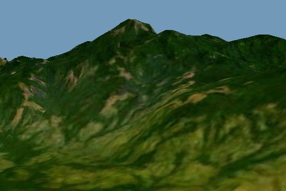
Misty forested ridges of the Imatong Mountains rising above the savannah

Photo · Wikimedia Commons

무엇인가요?

The Imatong Mountains rise up in the far south of South Sudan, where the land suddenly leaps from flat savannah into cool, misty highlands. Mount Kinyeti, the highest peak, reaches 3,187 metres - South Sudan's tallest point. Up here the air is fresh, the forest drips with moisture, and animals live that you would not find anywhere else in the country.

더 알려주세요

As you climb the Imatong Mountains, the world around you changes completely. At the bottom there is dry savannah grass and acacia trees. Higher up, the trees grow taller and thicker, mosses carpet the rocks, and clouds drift through the branches. This type of forest is called a cloud forest, because it lives inside the clouds.

The Imatong forests are home to colobus monkeys - beautiful black-and-white monkeys with long, silky tails that hang like scarves as they leap between trees. Chimpanzees also live in the lower forests. Both animals communicate with loud calls that echo off the mountain ridges.

Many of the mountain's streams flow down to feed rivers that eventually reach the Nile. Every drop of rain that falls on Kinyeti's peak begins a very long journey - eventually ending up in the Mediterranean Sea thousands of kilometres away.

For the communities living on the mountain slopes, the forests provide fruit, medicines, and firewood, and the streams give clean water. The mountains have always been an important landmark for travellers because their silhouette can be seen from enormous distances across the flat plains.

교실에서는

15분 안에 학급과 함께 살펴보세요.

함께 이야기해 보기

토론 질문

  1. 01As you go higher up a mountain, it gets colder and wetter. Why do you think that happens?
  2. 02Colobus monkeys have no thumbs. What would be harder to do if you had no thumbs? Try spending 30 seconds without using yours.
  3. 03A raindrop falls on a mountaintop and ends up in the sea. Can you trace its whole journey step by step?
해보기

학급 활동

Create a vertical 'mountain profile' diagram on A4 paper. Draw Mount Kinyeti from base to peak. Label the zones: dry savannah, tall forest, cloud forest, rocky peak. In each zone draw one animal or plant that lives there. Add an arrow showing the direction of a stream flowing down toward the Nile.

South Sudan에 대해 더 알아보기

South Sudan을(를) 특별하게 만드는 다른 것들

우리 학급이 South Sudan과(와) 만나길 원하시나요?

등록할 때 South Sudan을(를) 선택하시면 시간대 가능성을 보여드립니다.

Register your classroom